Adirondack Explorer Article on Loon Lake Mountain
Press Republican Article on Loon Lake Mountain
|
 |
|
Return to Hiking Page
Enter at the gate to the logging road directly across from Grass Pond. You will follow the logging road 1.7 miles to get to the lesser road on the left that leads to the fire ranger's cabin. Along the road you will pass several logging spurs off the main road, including one grass covered road on the left marked with a cairn of stones and orange ribbons. This is the shorter path to the summit. Follow this unused road until it dead ends into an area of logging and joins a path branching off to the right. Take the path to the right, it is reasonably well marked with orange ribbons.
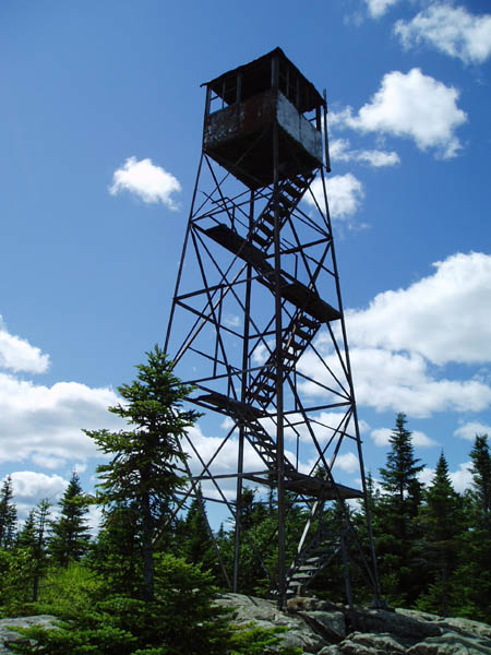
The ascent is marked not only with orange ribbons and orange reflectors, but after the wide foot bridge the path also follows the telephone poles that carried the phone line from the tower to the ranger cabin. The path will get moderately steep, before turning to the right and traversing along a slight ridge until it turns to the left and ascends steeply up a dry (sometimes) stream bed. Here the orange markings (and telephone poles) are fewer and farther between, however, with the exception of areas of blow down, it is simple to follow the streambed up. This is the hardest part of the hike.
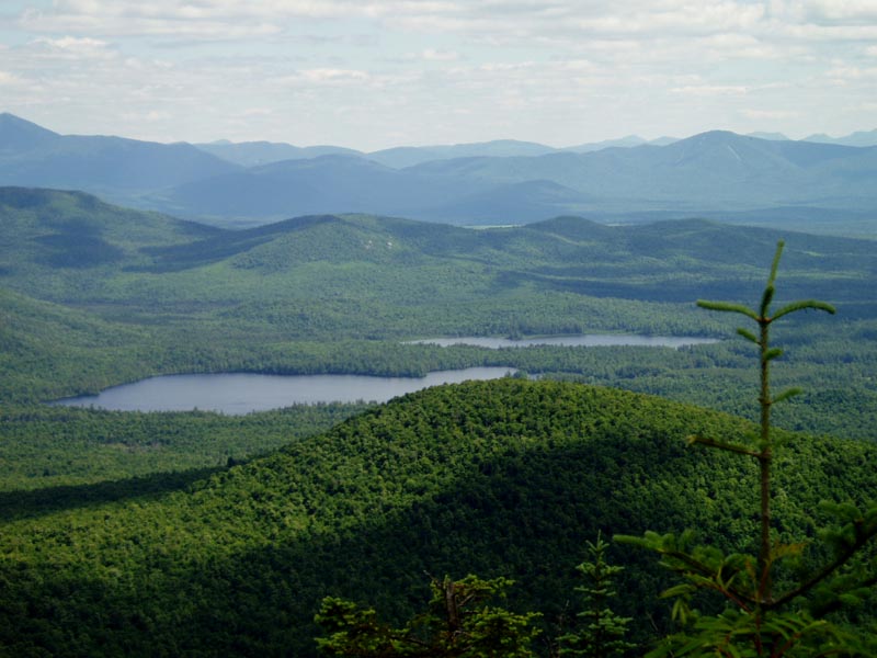
The stream bed will end at the top of a ridge and the remaining distance is an easy meander. Follow the herd path to the left for several hundred yards and you will come to the rocky top of Loon Lake Mountain and the fire tower. This herd path is not marked.
Adirondack Explorer Article on Loon Lake Mountain
Press Republican Article on Loon Lake Mountain
|
|
|
|
|